Sonar 3D-15
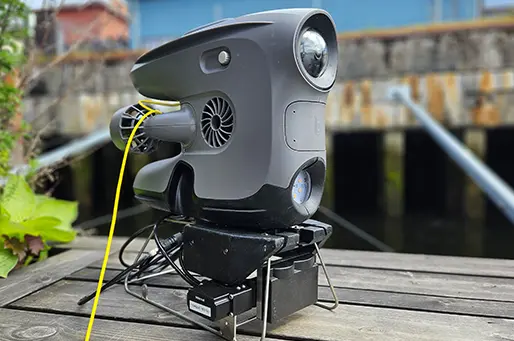
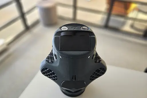
Water Linked’s Sonar 3D-15 is an advanced 3D multibeam imaging sonar with a range of 15 meters. With real-time 3D data now accessible from such a compact sensor, countless opportunities for advanced levels of autonomy will emerge.
Advanced 3D multibeam imaging
Immediately generate a complete 3D image
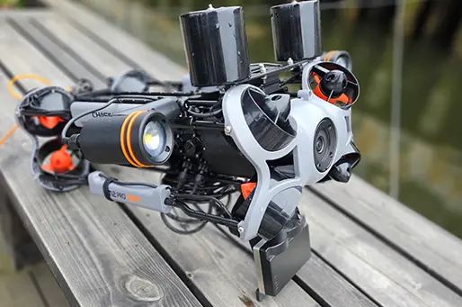
Upgrade small vehicles with 3D sonar technology
Only 12 x 8 x 4 cm and 0.39 kg in-water weight
Features

15m acoustic range, perfect for inspections
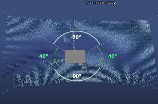
90° horizontal and 40° vertical field of view
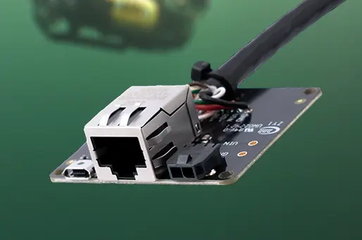
Ethernet with 10 megabits connection
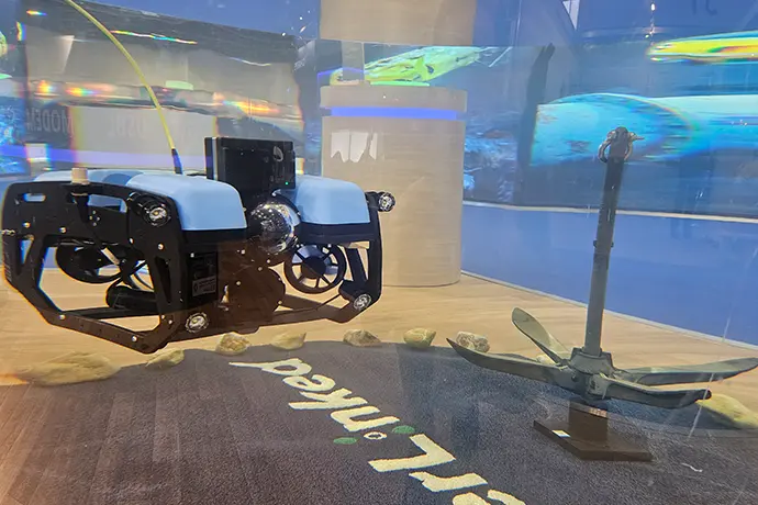
Extremely small size and low weight

Web-based GUI; no software needed.
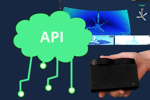
Merge easily with third-party software
Technical specifications
Mechanical
-
Device height
80 mm - Device width 120 mm
-
Device depth
40 mm
-
Device weight (air)
660 grams
-
Device weight (submerged)
390 grams
-
Depth rating
300 meter
-
Materials
Polyurethane, Stainless steel 316
Electrical / Interface
-
Input voltage
10-30 Vdc
-
Power consumption
20 W
-
Power-on current surge
60 W
-
Physical interface
3m cable with interface module
6 wires (Power / Ethernet) -
Indicator
Status LED (Power)
-
Communication
Ethernet (10/100/1000 Base-T)
-
Protocols
Water Linked API
Acoustic / Performance
- Transducer frequency 1.2 MHz - Low Frequency
- 2.4 MHz - High Frequency
- Transducer beam angle 0.6° horizontal, 2.4° vertical - Low Frequency
- 0.4° horizontal, 1.1° vertical - High Frequency
- Ping rate 5Hz - Low Frequency
- 20 Hz - High Frequency
-
Sensor assist
Integrated AHRS / IMU
- Range 15 m - Low Frequency
- 4 m - High Frequency
-
Latency
200 ms
- Resolution 4 mm - Low Frequency
- 1.5 mm - High Frequency
Approvals
-
CE certificate
-
RoHS compliant
See clearly in shallow and murky waters
Shallow water, often characterized by low visibility and high turbidity, typically renders optical cameras ineffective. While traditional 2D sonars offer some improvement, they fall short in providing a comprehensive understanding of the surrounding environment.
The Sonar 3D-15 is at the forefront of underwater exploration, delivering a clear, three-dimensional acoustic image that penetrates even the murkiest of waters. This technology creates the ability for intuitive navigation, greatly enhancing the user’s capability to maneuver around obstacles and pinpoint targets.
Immediately understand what you see
Our 3D sonar immediately delivers comprehensive, easy-to-understand images of underwater environments, enhancing decision-making speed and accuracy.
Each acoustic "ping" generates a complete 3D image without the need for scanning or post-processing, which is critical for navigation and obstacle avoidance. 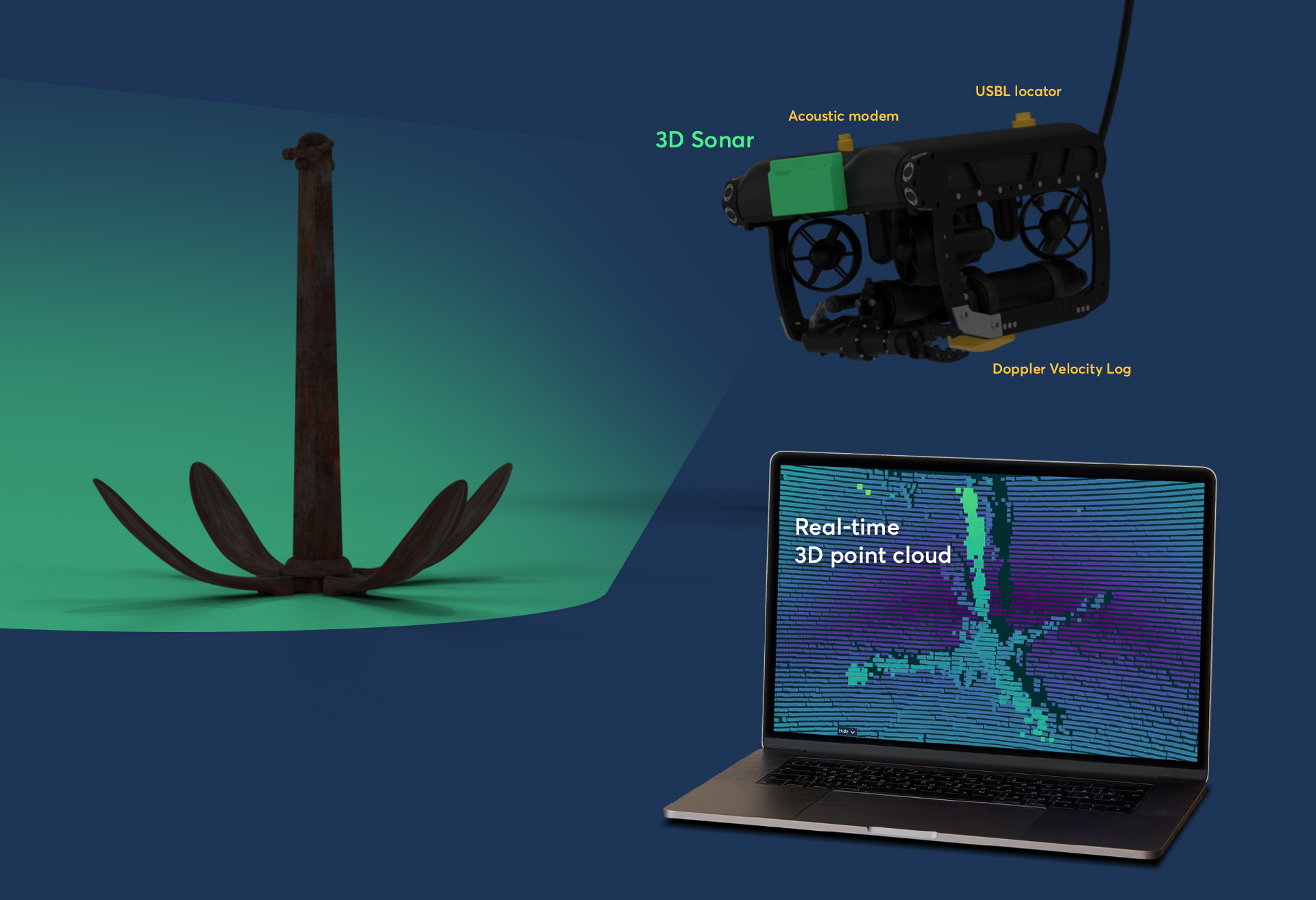
From detailed inspections to autonomous decision-making
The Sonar 3D-15 generates a digital point cloud output that you can integrate with third-party software. This allows you to create point clouds specifically for your purposes, such as creating various models of underwater targets and terrain and performing detailed inspections.
You can also use the output to support real-time autonomous navigation and decision-making. Use the geo-referenced point cloud data as you see fit!
Compact and easy to use
The Sonar 3D -15 sets itself apart with its compact and efficient design, boasting a 300 meter operational depth and a mere 0.5 kilogram in-water weight.
Its small size makes it suitable for an extensive variety of ROVs, from the smallest to those of larger scales, and empowering them with the ability to discern targets in challenging conditions.
Aligning with the Water Linked commitment for ease of use, the sonar’s Graphical User Interface (GUI) is designed for accessibility through a web-based browser, displaying real-time data in a 3D shaded view.
Follow the industry trend
As underwater vehicles become smaller and more accessible, the demand for affordable, lightweight sensors is skyrocketing. Stay ahead of the curve and make sure that you meet your customers' needs.
It is the first time I’ve seen such a major step forward in acoustic sensing, and I’m deeply impressed by the years of research and vision the Sonar 3D-15 represents.
Trygve Olav Fossum - CEO at Skarv Technologies
Downloads / Resources
Contact us for more information

"Hi there, are you not ready to commit yet or do you have an inquiry regarding your specific needs? Simply request a quote, and we'll send one over promptly. Alternatively, book a meeting to discuss your needs in detail."
- Scott
REQUEST A QUOTE BOOK A MEETING


