Disaster Response
Our products provide precise navigation, high-resolution imaging, accurate positioning, and reliable communication, all of which are critical for successful disaster response. These capabilities ensure that response teams can effectively assess damage, locate survivors, and plan recovery operations.
In the critical aftermath of disasters such as tsunamis, floods, hurricanes, and infrastructure collapses, timely and effective underwater operations are essential. Divers, Remotely Operated Vehicles (ROVs), and Autonomous Underwater Vehicles (AUVs) play pivotal roles in search and rescue, damage assessment, and environmental monitoring. Water Linked's advanced products significantly enhance the capabilities of these underwater assets, improving safety, efficiency, and effectiveness in disaster response missions.
Supporting Divers in Challenging Environments
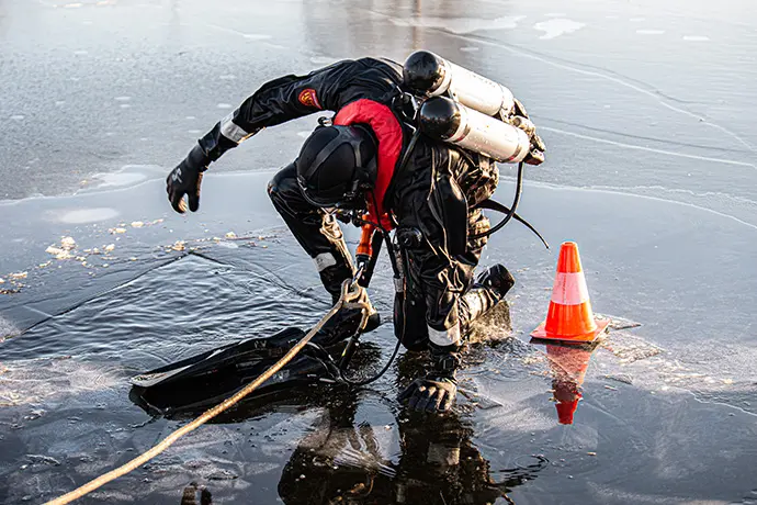
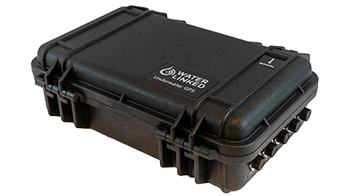
Water Linked's Underwater GPS (UGPS) provides real-time positioning of divers, enabling surface teams to monitor their location in complex and hazardous environments. This acoustic positioning system is crucial for coordinating rescue efforts and ensuring diver safety in low-visibility conditions or strong currents.
Accurate positioning allows for better coordination among multiple divers, preventing overlap and ensuring thorough coverage of search areas. In disaster zones with submerged structures, such as collapsed buildings or flooded urban areas, this precision is certainly advantageous.
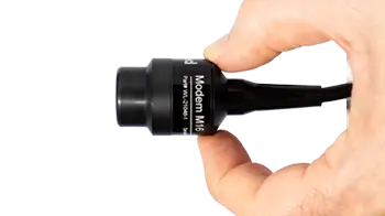
Our Acoustic Modem can be used as part of a system to allow divers to communicate seamlessly with surface teams, transmitting critical information such as status updates, environmental data, and requests for assistance. Real-time communication enhances decision-making, allowing surface coordinators to adjust strategies based on the divers' on-site observations, thereby improving situational awareness and mission effectiveness.
Empowering ROVs for Hazardous Environment Access
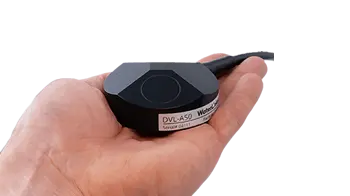
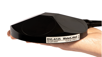
Water Linked's Doppler Velocity Logs (DVLs), like the DVL A50 and DVL A125, provide ROVs with accurate velocity measurements relative to the seabed. This ensures precise maneuvering in hazardous environments where strong currents, debris, or contaminated water pose significant risks. Enhanced navigation allows ROVs to maintain stability while inspecting submerged infrastructure, such as bridges, dams, and pipelines, to assess structural integrity and identify hazards without endangering human life.
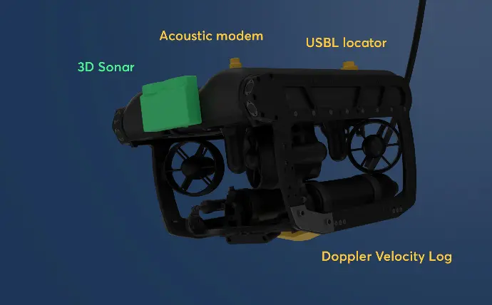
Our UGPS systems offer surface operators the ability to track ROVs in real-time, which is essential for mapping debris fields, locating survivors, and assessing damage efficiently. Even near the surface or around submerged structures where traditional systems struggle, our UGPS provides reliable positioning, ensuring ROVs can navigate within confined or cluttered spaces effectively.
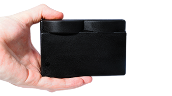
The Sonar 3D-15 delivers real-time, high-resolution three-dimensional images, allowing ROVs to "see" in murky or debris-filled waters where cameras are ineffective. This advanced imaging capability enables teams to inspect underwater portions of collapsed structures, identify hazards, and support repair strategies with unprecedented detail.
Advancing AUV Capabilities for Large-Area Surveys
Our DVLs enhance AUV navigation by providing accurate velocity data, which is crucial for large-area surveys and search missions over extensive regions affected by disasters. Combining DVLs with an Inertial Navigation System (INS) suppresses drift errors inherent in inertial sensors, ensuring that AUVs maintain precise trajectories during autonomous operations without direct human control.
UGPS provides absolute positioning of AUVs, which is helpful when creating detailed maps of altered seafloor landscapes post-disaster, such as after tsunamis or hurricanes. Accurate positioning allows for consistent data collection points when monitoring water conditions such as contamination levels and sediment displacement, aiding environmental impact assessments.
AUVs equipped with the Sonar 3D-15 can identify changes in underwater topography and detect potential navigation hazards, which is useful for safe navigation and planning in altered environments. The high-resolution imaging aids in locating submerged vehicles, debris, or missing persons, enhancing the effectiveness of search missions.
Our Acoustic Modems enable AUVs to send data samples, status updates, and alerts to surface operators in real-time, facilitating immediate analysis and response. In missions requiring multiple AUVs, our modems support inter-vehicle communication, ensuring coordinated efforts and efficient area coverage.
One example of an AUV using our Modem M16 is Watbots, of which you can find a video on the right side.
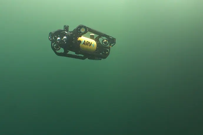
Photo courtesy of Boxfish Robotics
Let divers, AUVs, and ROVs work together with our products
Here are some examples of how divers, AUVs, and ROVs can work together during disaster response missions using Water Linked products.
In the aftermath of a tsunami, AUVs can be equipped with our DVLs and UGPS to help create detailed maps of altered coastal seabeds, identifying the location of new underwater hazards. ROVs with our 3D Sonar can assess port and harbor infrastructure, while divers can use our UGPS for safe navigation during repairs.
During flood responses, ROVs utilizing DVLs and UGPS are able to navigate submerged streets to locate survivors and assess damage to critical infrastructure like tunnels and subways. Acoustic Modems enable real-time data transmission in areas where traditional communication is compromised.
In hurricane recovery efforts, AUVs have the ability to survey offshore oil platforms and wind farms for damage using DVLs to support precise navigation and 3D Sonar for detailed imaging. ROVs can then inspect underwater pipelines with enhanced control and stability thanks to our DVLs high accuracy velocity inputs.
Following infrastructure collapses, ROVs can explore submerged wreckage using our 3D Sonar to assist in investigations, while divers equipped with UGPS can safely retrieve debris.
Empower first responders and recovery teams
By providing precise navigation, accurate positioning, reliable communication, and advanced imaging, our products empower first responders and recovery teams to conduct missions more safely and effectively. Integrating our solutions into disaster response efforts ensures thorough search and rescue operations, detailed damage assessments, and efficient recovery activities, ultimately improving outcomes in the face of natural and man-made disasters.
Product features
Small size
Our sensors are all developed to fit on small vehicles as well as bigger ones, without compromising performance.
Light weight
Lightweight sensors allow fitment on lighter vehicles, and leave you with excess payload capacity for other equipment.
Low power consumption
Our smart, proprietary technology leaves more power for your other devices or can help free up payload capacity due to requiring
smaller battery packs.
The DVL's output was fused with other sensor data to deliver even more precise navigation and altitude control, enhancing our AUVs' ability to carry out operations and navigate with great precision.
- Craig Anderson, co-founder, Boxfish
Product options
Customer stories
