Mine Counter Measures
Enhance your ROV's and AUV's MCM capabilities with Water Linked's advanced technology
Classifying mines and destroying them still rely heavily on expert divers, who are placed in harm’s way. Alternatively, AUVs or ROVs can be used, which are expensive if treated as expendable devices. With Water Linked’s products, AUVs and ROVs can be used more precisely and reliably, increasing safety and efficiency in MCM missions.
Because Water Linked’s products are small and lightweight, they can be integrated into small, cost-effective underwater drones, opening up new possibilities in MCM missions. For example, you can launch small but highly capable AUVs and ROVs from surface ships, small craft, and even helicopters to locate and potentially neutralize mines within minutes of deployment.
Safely get closer to mines with increased vehicle control
Our DVLs provide real-time velocity and positioning data, enabling precise navigation, station-keeping, and terrain following. When integrated into your underwater vehicle our DVLs can significantly enhance maneuverability, allowing operation within safe proximity to mines for identification and neutralization.
The DVL can increase your operations' accuracy, efficiency, and safety by working alongside other systems.
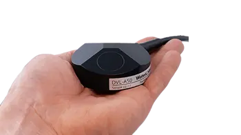
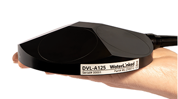
Our DVL A50’s compact size is perfect for small ROVs and AUVs that need to navigate tight spaces, while our DVL A125’s extended range suits deeper water operations.
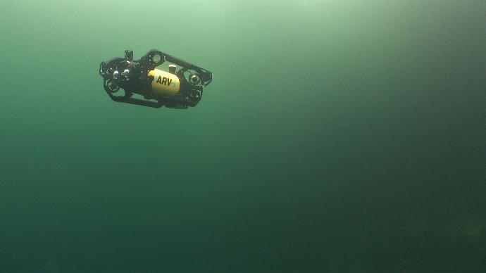
Photo courtesy of Boxfish Robotics
Systematic minefield coverage of your AUV
The DVLs from Water Linked provide the INS in your AUV with accurate velocity data, increasing its capability to follow high-precision pre-programmed paths that can lead to a more systematic minefield coverage.
Our DVLs provide real-time adjustments, optimize path and speed, and correct Inertial Navigation System (INS) errors for better positioning accuracy. They also enable hovering, which can lead to more detailed surveys of potential mine-like objects (MLOs).
Classify mines faster with real-time 3D imaging
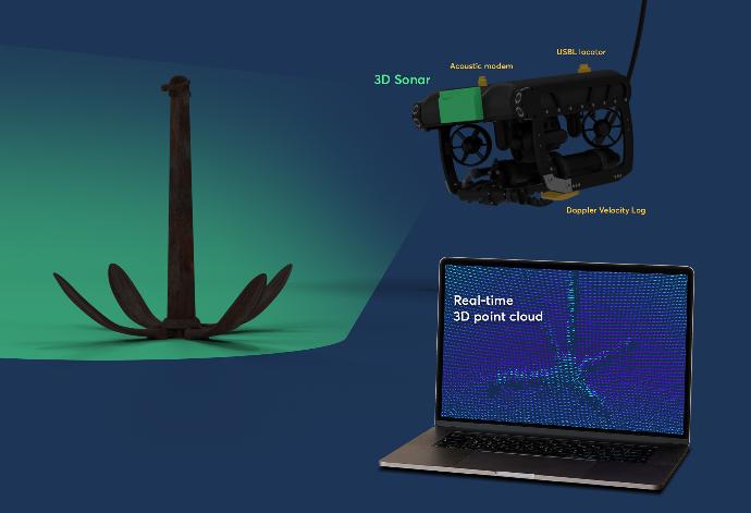
Our Sonar 3D-15 provides detailed real-time 3D images of underwater environments. This capability is crucial for identifying and classifying underwater mines, including those that are partially buried or camouflaged.
Real-time sonar imaging can help operators distinguish between mines and other objects, reducing false alarms and enabling quick, informed decision-making on whether to proceed, mark, or neutralize detected objects.
Reliable inter-AUV communication in long-term MCM missions
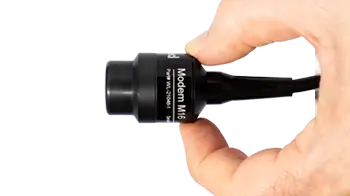
The Modem M16 is a small, low-data, and low-power acoustic modem that integrates seamlessly into any AUV, from large to compact platforms. It’s ideal for operations that require efficient, minimal communication, including MCM missions.
The Modem M16 supports crucial functions such as providing waypoint updates, inter-AUV coordination, and task synchronization while conserving energy thanks to its low power design. This energy efficiency ensures sustained operations over long-duration missions, where AUVs must navigate challenging environments for extended periods.
With its reliable communication capabilities, the modem enhances coordination between AUVs, making it ideal for MCM tasks where precise communication is essential to avoid mines and ensure mission success in emergency scenarios or hostile waters.
In the video on the left, you can see how our Modem M16 helped the Desert WAVE team win the RoboSub 2024 competition. The Desert WAVE team used two of our M16 modems to enable communication between their two autonomous underwater vehicles, Dragon and Baby Dragon.
Map minefields more accurately with our UGPS
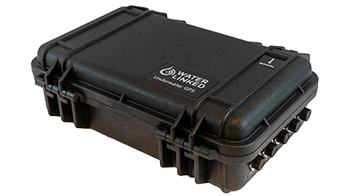
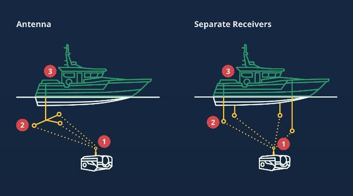
Our SBL system, UGPS, allows surface operators to track their assets. This is essential for mapping minefields, tracking the movement of ROVs and AUVs, and documenting the locations of identified threats. Our UGPS can help ensure that all detected mines are accurately recorded, which is vital for planning safe routes for subsequent naval operations.
Our UGPS also provides a means for vehicles operating autonomously below the surface to get a position-fix from the surface, where there is GNSS. This surface fix is helpful for vehicles employing navigation solutions that accumulate errors over time or distance.
Water Linked’s UGPS G2 system is available in two versions: one with a 100-meter range and one with a 300-meter range. Our UGPS was specially developed to make it very easy (no need for third-party integration) to track an ROV, AUV, or diver, especially in challenging environments such as shallow water or around installations.
The Best Choice for Big and Small AUVs
Our navigation solutions are tailored to fit the best small AUVs, providing a compact yet powerful tool suite to meet the unique challenges of underwater navigation and survey tasks. By integrating our DVL, USBL, acoustic modem, and 3D sonar technologies, you equip your AUV with advanced navigation solutions that can help ensure mission success in even the most demanding underwater conditions.
Elevate the capabilities of your AUVs or ROVs with our state-of-the-art navigation solutions for Mine Countermeasure missions. Explore our range of products today.
Product Features
Small size
Our sensors are all developed to fit on small vehicles as well as bigger ones, without compromising performance.
Light weight
Lightweight sensors allow fitment on lighter vehicles, and leave you with excess payload capacity for other equipment.
Low power consumption
Our smart, proprietary technology leaves more power for your other devices or can help free up payload capacity due to requiring
smaller battery packs.
"Water Linked’s agility in addressing our needs ensures seamless integration and operational efficiency. Their team is always available to provide prompt and effective support. We also value the personal touch that fosters a relationship grounded in mutual respect and trust.
"
- Cody Warner, Director of Sales and Marketing, Deep Trekker
Product Options
